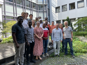
As a concrete outcome of the meeting, participants defined indicators for the identified agricultural practices "System of Rice Intensification" (SRI) and "Integrated Soil Fertility Management." Central inputs in the three-day exchange came from field activities in the project regions. The RUB team (Stefanie Steinbach, Valerie Graw, Niels Dedring, and Andreas Rienow) organized a two-week field research trip at the beginning of the year in collaboration with partners from the ILR, University of Bonn, the German Aerospace Center (DLR), and Senegalese partners IPAR and Manobi.
Through expert interviews in the agricultural and financial sectors, workshops, and participatory mapping in northern Senegal, problems were identified, and needs regarding spatial data were assessed. It was found that precise geoinformation on field size is often inadequately determined, leading to financially and ecologically unsustainable management of the fields. Based on these and other findings, digital geo-tools and training materials are currently being developed, including online courses, apps, and a hackathon with affordable sensors and microcontrollers.
Students of geography and related disciplines (computer science, agricultural sciences, environmental sciences, etc.) are welcome to get involved in student projects and theses: Theses of the AG Interdisciplinary Geoinformation Sciences. Interested students should contact Junior Professor Dr Andreas Rienow.
COINS is funded by the BMBF under the funding code 01LL2204E from 2022-2026: Project page COINS - Digital technologies support the sustainable intensification of farming methods in West Africa