![]()
![]()
![]()
![]()

The four-day programme included several keynote speeches, including one by C. Tucker (NASA) on "Hyper-Spatial Remote Sensing", as well as numerous sessions on topics such as land use classifications, unmanned aerial systems (UAS), drylands, urban developments and conflicts, and education sessions. In addition, there were further opportunities for informal exchange in the form of a city tour of Manchester and the symposium dinner.
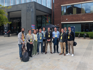
The working groups of the Interdisciplinary Geoinformation Sciences and Remote Sensing were represented on site with 10 employees and contributions in various sessions.
In the first two days, Jan-Philipp Langenkamp and Torben Dedring presented their research in the field of deep learning. Jan-Philipp Langenkamp was represented in the Semantic Session with his approach to segmenting sealed surfaces on high-resolution orthophotos using the Segment Anything Model (SAM). In the LULC session, Torben Dedring gave insights into his evaluation of synthetically generated satellite images using Generative Adversarial Networks (GAN) based on Sentinel-2 data and land cover information.
In the Urban Session, chaired by Carsten Jürgens and Andreas Redecker, Andreas Rienow used a multi-temporal analysis to show spatial injustice in conflict-affected regions. Anna Hellings also presented her calculation of a multi-temporal data set on local climate zones in European cities.
In the Global South session, Ricardo Gellert Paris used an analysis of satellite data on night-time lighting to highlight spatial injustices associated with extractive economic dynamics in the Nacala Corridor in Mozambique.
In the concluding Education Sessions, Henryk Hodam and Roman Hiby presented their approaches to the development of satellite data-based educational content. Henryk Hodam presented a multi-level perspective on the development of Earth observation content for different target groups, while Roman Hiby presented the Earth-Moon system and its implementation in school lessons using augmented reality (AR), among other things.
In addition to the presentations, a personal exchange with a Kenyan project partner from the Dedan Kimathi University of Technology (DEKUT), Kuria Thiong'o, took place. In the joint BMBF-funded project "MC2FM", a participatory approach to mitigating the effects of climate change and reforestation in the Muringato catchment area is being developed with the GI.
Kuria Thiong'o was represented with a contribution in the Education Session on the greater involvement of pupils in participatory environmental protection:
20/06/2024 "Enhancing Learners' Involvement In Participatory Environmental Conservation" Bartholomew Thiongo Kuria, Wisdom Kipkemboi, Simon Wachira Muthee, Martin Wainaina Chege, Johanna Anyesi Wanjala, Andreas Rienow
There was also a project-related poster contribution:
18.06.2024 "Towards Sustainable Water Resource Management: WebGIS-Based Real-Time River Discharge Optimisation System" Martin W. Chege, Kuria B. Thiong'o, Arthur W.Sichangi, Moses M. Ngigi, Andreas Rienow
Other presentations of the GI:
17.06.2024 "Fine-Tuning SAM for Accurate Impervious Surface Segmentation in Very High-Resolution Orthophotos" Jan-Philipp Langenkamp, Thomas Chrisitan van Dijk, Andreas Rienow
18.06.2024 "Evaluation of Large Scale Synthetic Multispectral Satellite Images using Generative Adversarial Networks on Land Cover and Sentinel-2 Data" Torben Dedring, Andreas Rienow
19.06.2024 Chair der „Urban Sessions”, Carsten Jürgens, Andreas Redecker
19.06.2024 "A Comparative Multitemporal Analysis of Spatial Justice and Sustainable Development in Conflict-affected Regions: Lessons from the Syrian War and the Nacala Development Corridor in Mozambique" Andreas Rienow, Mounir Azzam, Ricardo Gellert Paris
19.06.2024 "Calculating a Multitemporal Local Climate Zone Dataset for European Cities" Anna Hellings, Andreas Rienow, Benjamin Bechtel, Matthias Demuzere
19.06.2024 "Nighttime Lights Time Series Analysis Unveil Spatial Inequalities and Extractive Economic Dynamics along the Nacala Development Corridor in Lichinga, Mozambique" Ricardo Gellert Paris, Andreas Rienow
20.06.2024 "A Multi-Level Perspective on Developing Earth Observation Educational Content for Diverse Audiences" Henryk Hodam, Andreas Rienow
20.06.2024 "The Earth-Moon System with Remote Sensing in Education - Implementing Lunar and Cis-Lunar Topics into the School Curriculum" Roman Hiby, Claudia Lindner, Andreas Rienow
The next EARSeL Symposium 2025 will take place from 26 to 29 May in Prague, Czech Republic. Session and workshop proposals can be submitted until 30 September. The period for submitting abstracts starts on 15 October. The deadline so far is 1 December 2024. Further information can be found here.
Copyright © Geographical Institute 2024
Last update: Jul 11, 2024