![]()
![]()
![]()
![]()
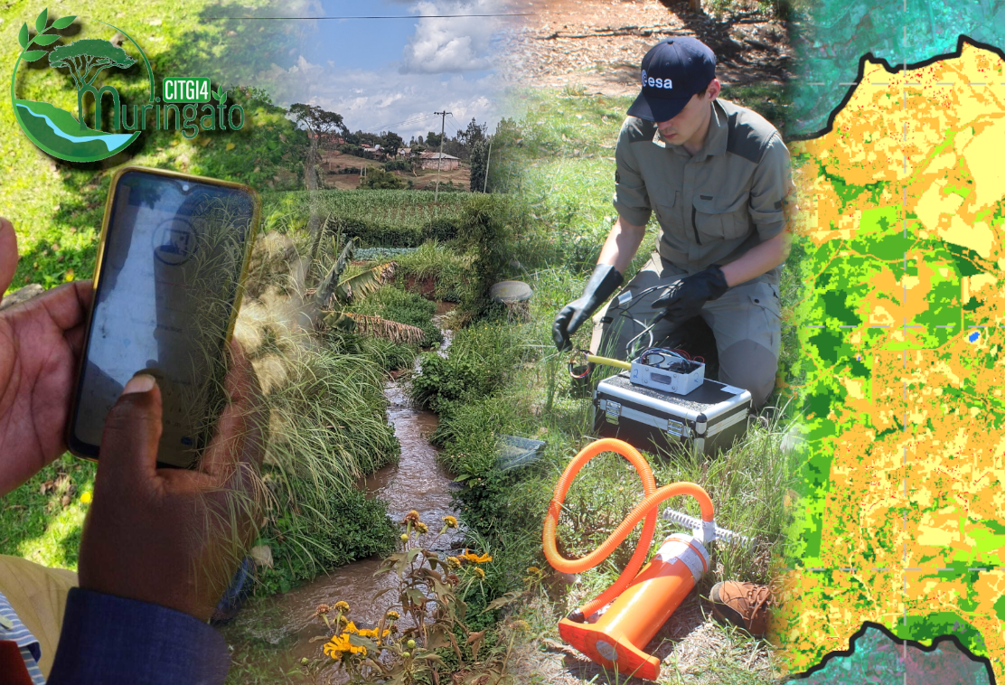
The overall objective of the project is to develop a participatory approach to sustainable environmental monitoring and management of the Muringato sub-catchment in central Kenya by combining geo-information technologies with citizen science approaches to effectively address challenges that especially arise in the coverage of the 225 km² area. Building on preliminary work of the African partner (Institute of Geomatics, GIS & Remote Sensing of Dedan Kimathi University of Technology in Nyeri), the project aims to involve citizens and local stakeholders in the mapping, monitoring and management of environmental resources through the implementation of GIS tools for e- and m-learning and the development of a crowd-mapping platform to quantify and locate relevant environmental parameters. These will feed into an integrated land-cover-water modelling. The results will be made available to the local community and decision-makers through a Spatial Decision Support System.
Project Info
Project-ID: 01DG20022
Project Period: 2020 - 2023
Projekt Lead:
Copyright © Geographical Institute 2024
Last update: Apr 07, 2024