![]()
![]()
![]()
![]()
Cognitive Map
The term cognitive map has been used in a diverse and interdisciplinary portfolio of publications since it was first introduced by the psychologist Eduard C. Tolman (1948). The term is useful and confusing at the same time. It misleads people to emphasising the convenient word “map” and, thus, to regarding the term in a strictly cartographic sense – a cognitive map, however, is not to be seen as a coherent whole designed according to cartographic principles, it is a metaphorical term and rather refers to a “collage” (Tversky, 1993) including the “awareness, impressions, information, images, and beliefs that people have about environments” (Moore & Golledge, 1976). A cognitive map is the result of the (re‐)processed experiences individuals have made with the geospatial reality. It concerns information about places, their spatial relations and the presence or absence of specific objects. This spatial knowledge is based on the experiences in the environment itself (direct experience) or on information learned from cartographic visualisations (indirect experience). These experiences are not restricted to information taken up visually. In a cognitive map, perceptions of all human senses are merged together.
Project Info
Project-ID: DI 771/7-1 und DI 771/7-2 (Fortsetzung) KU 2872/4-2
Project Period: 2012 - 2018
Proposer:

Apart from the more recent development to visualise emotionally evaluated space, most of the research into cognitive maps, by today, has concerned how individuals acquire, encode, store, recall and decode spatial information. As such, there have been quite some important studies that identified spatial distortions as consequences of normal processing:
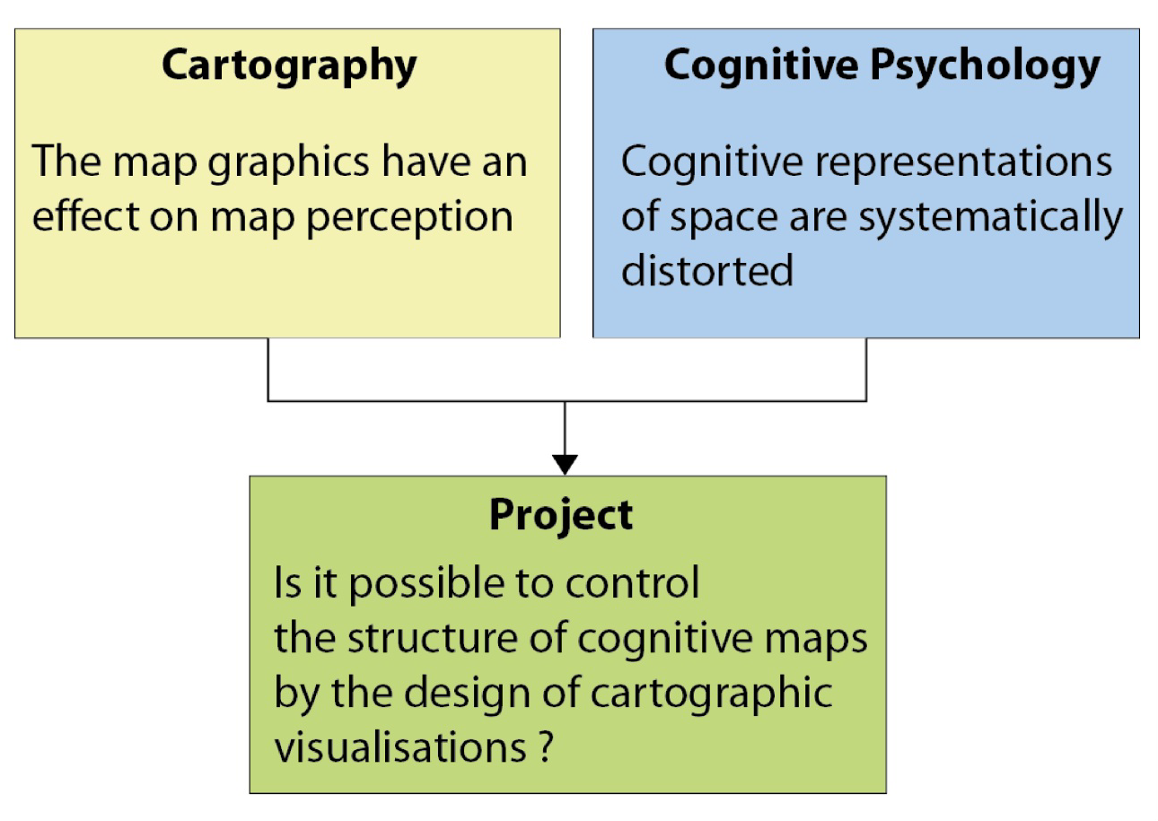
Previous research on cognitive maps, from a rather psychological perspective, has shown that quite some perception‐based phenomena influence the accuracy when humans try to learn the locations of spatial objects from maps or map‐like displays. People inherently tend to organize their memory in an easy way. When reading maps, the visual perception of humans is manipulated by some organising effects, such as grouping objects by proximity, by (shape and colour) similarity, by symmetry, by connectedness and by common region. From a cartographer’s perspective, it remains unclear whether one could modify common map design principles in order to counteract spatial distortions that are called forth by the map graphics and the way they are perceived. This is the point of departure for the aim of a current interdisciplinary research project.
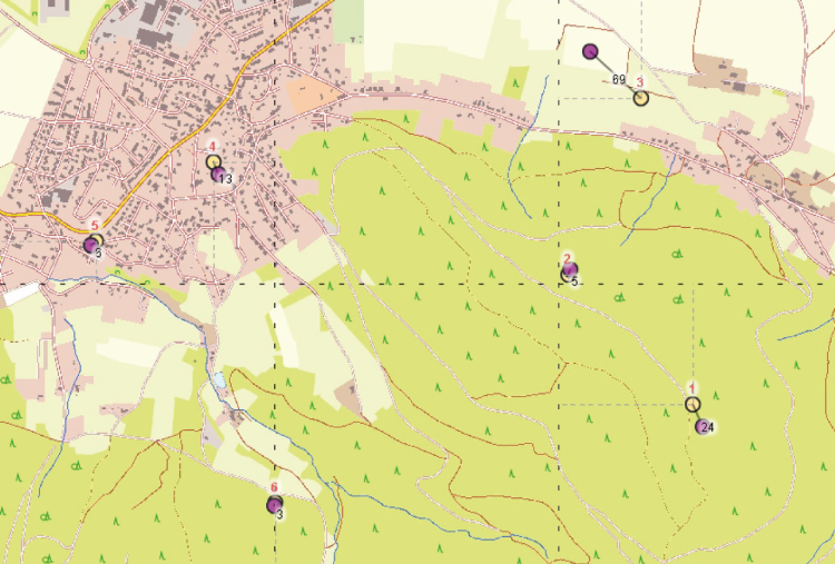
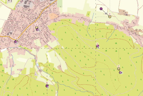
 and realled (yellow) object locations (automatically created ba an Adobe© Flash© tool used for empirical data acquisition).")
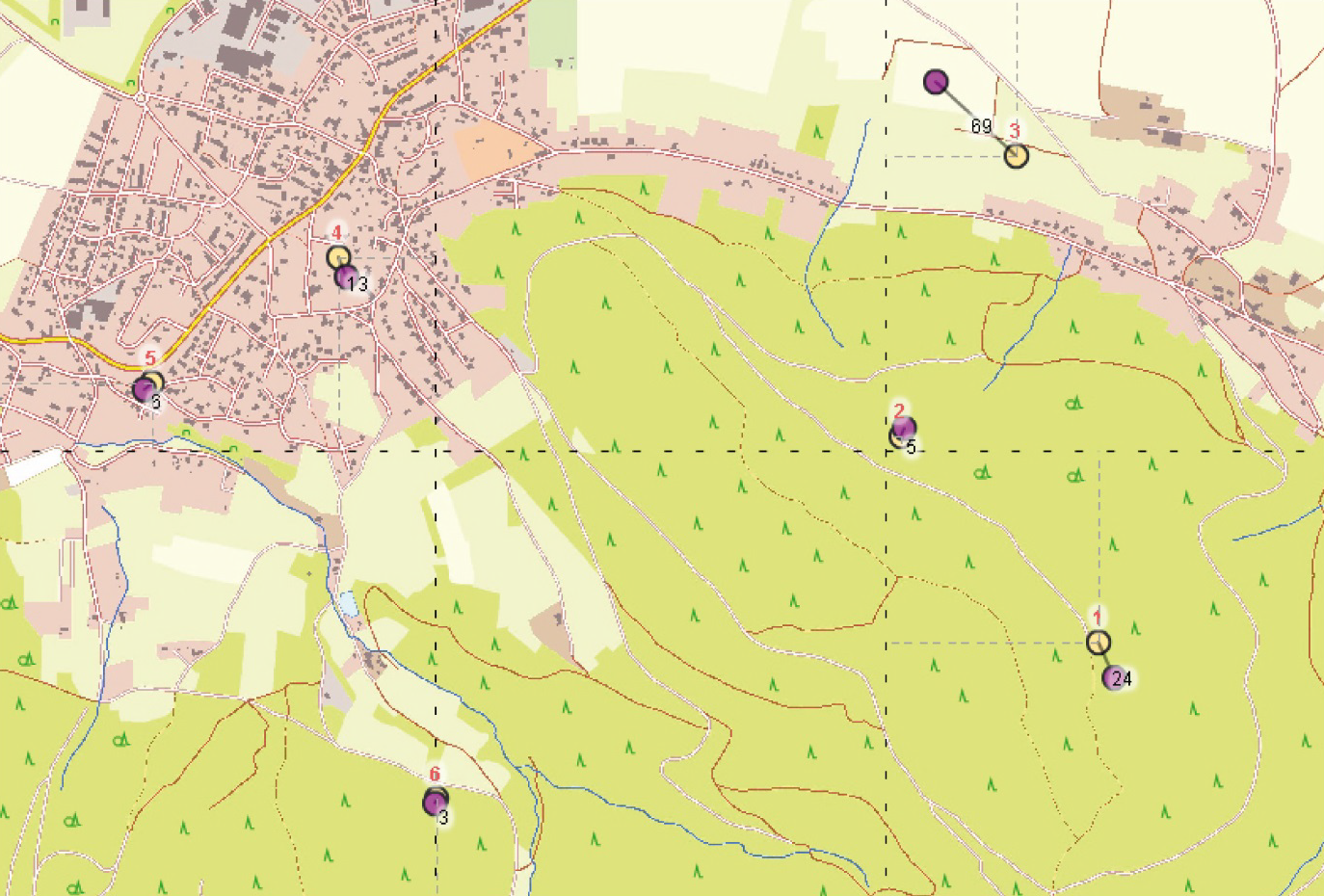
The aim of this project is to identify and optimise the design of specific map features in order to reduce the perception‐based distortion errors people learn from cartographic maps and store in their cognitive maps. Involving both the Geography and Psychology Department of the Ruhr‐University Bochum (RUB), the project intends to exploit the findings on the structures of spatial memory in order to optimise the principles of map design. The improvement of design principles especially relies on the idea that the construction of cognitive maps may be controlled by the map graphics. It has so far not been explored which specific elements of the map graphics are the key features affecting the accuracy when recalling (see Fig. 1 & 2) objects learned from maps (indirect experience). After qualifying these map features, they are supposed to be quantified. In other words, their design shall be altered and examined in order to counteract and reduce the spatial distortions people get from maps and erroneously carry around in their heads. The ideal result of the project would be a catalogue of qualified and quantified map features that help to store map information more accurately: cartographers shall be provided with reliable statements how to outsmart perceptionbased distortion errors and, consequently, how to design a map to make map communication a bit more efficiently. The idea behind the project is illsutrated in figure 3.

Bestgen, A.-K., Edler, D., Dickmann, F., & Kuchinke, L. (2013). Grid or no grid: distance distortion in recognizing spatial information from complex cartographic maps. In M. Knauff, M. Pauen, N. Sebanz, & I. Wachsmuth (Hrsg.), Cooperative minds: social interaction and group dynamics: 35th Annual Meeting of the Cognitive Science Society (CogSci 2013) ; Berlin, Germany, 31 July - 3 August 2013 (Bd. 1, S. 193–196). Abgerufen von http://mindmodeling.org/cogsci2013/cogsci2013_proceedings.pdf
Dickmann, F., Edler, D., Bestgen, A.-K., & Kuchinke, L. (2013a). Spatial distortions in cognitive maps - a chance and challenge to enrich the principles of map design. Kartographische Nachrichten, 63(3), 174–181. https://doi.org/10.1007/BF03546131
Copyright © Geographical Institute 2024
Last update: Feb 23, 2024