![]()
![]()
![]()
![]()

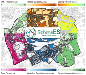
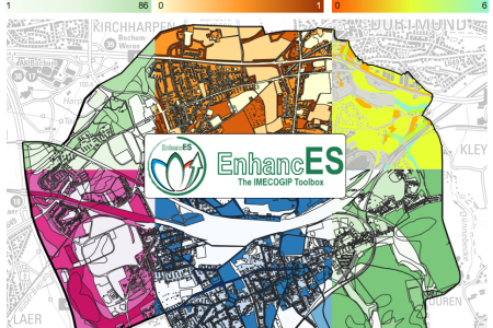
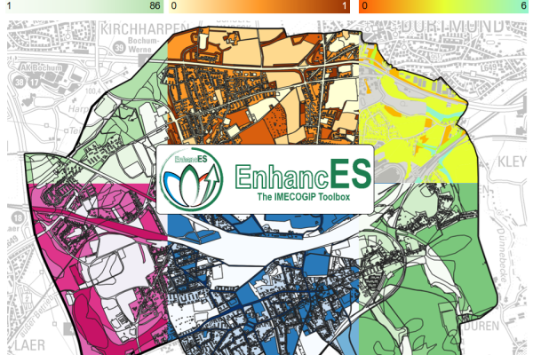
EnhancES is a toolbox developed by IMECOGIP for the quantification of ecosystem services. 🌻 Models for various ecosystem services can be run on the basis of existing geodata. This results in maps that can be easily interpreted. They help to identify areas that provide a high or low performance in the respective ecosystem service. EnhancES outputs come in maps. Pollutant filtration, habitat suitability for pollinators, cooling intensity, base flow, flash flood regulation, and carbon sequestration. Except for habitat suitability and waterflow regulation the results are given in biophysical units. For instance pollutant filtration is quantified in kg/year, cooling intensity in Kelvin (equivalent to °C), and base flow in mm/year. 🌧 All in all, 20 ecosystem services are available.
#IMECOGIP #EnhancES #EcosystemServices #NatureBasedSolutions
Copyright © Geographical Institute 2025
Last update: Apr 23, 2025