![]()
![]()
![]()
![]()
Ein kürzlich in der Zeitschrift „Ecosystem Services“ veröffentlichter Artikel stellt EnhancES vor, eine vom IMECOGIP-Projekt entwickelte Open-Source-QGIS-Toolbox für die räumliche Analyse von Ökosystemleistungen. EnhancES wurde für die Forschung und die Planungspraxis entwickelt. Die Toolbox ermöglicht es Anwendern, ein breites Spektrum von Ökosystemleistungen, darunter Versorgungs-, Regulierungs- und kulturelle Leistungen, zu kartieren, größtenteils zu quantifizieren und zu bewerten. Die flexible Architektur von EnhancES unterstützt die Arbeit mit lokalen und regionalen Datensätzen, erleichtert Szenarioanalysen und ermöglicht die Anpassung bestehender, oder die Integration neuer Tools. Durch die Kombination von räumlich expliziten Datensätzen mit biophysikalischen Werten in einem offenen und modularen Rahmen adressiert EnhancES wichtige methodische Herausforderungen bei der Bewertung von Ökosystemleistungen. Die Toolbox ist besonders wertvoll für Forscher und Praktiker, die ein zugängliches, benutzerfreundliches Tool zur Unterstützung interdisziplinärer und angewandter Arbeit suchen. Als nächsten Schritt plant das IMECOGIP-Team die Entwicklung und Durchführung von praktischen Schulungen, um die Nutzung und Weiterentwicklung von EnhancES innerhalb einer wachsenden 'community of practice' zu fördern.
Website: https://www.geographie.ruhr-uni-bochum.de/physik/imecogip.html.de
LinkedIN: https://www.linkedin.com/company/imecogip
Paper & Toolbox: https://doi.org/10.1016/j.ecoser.2025.101744
EnhancES download: https://github.com/imecogip/EnhancES
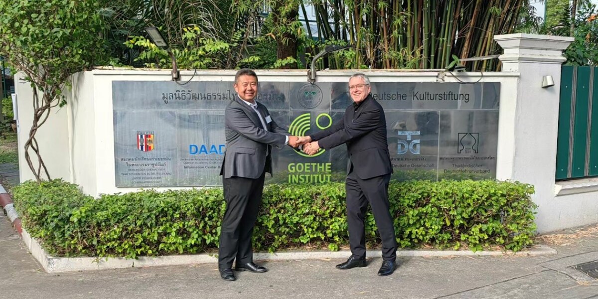
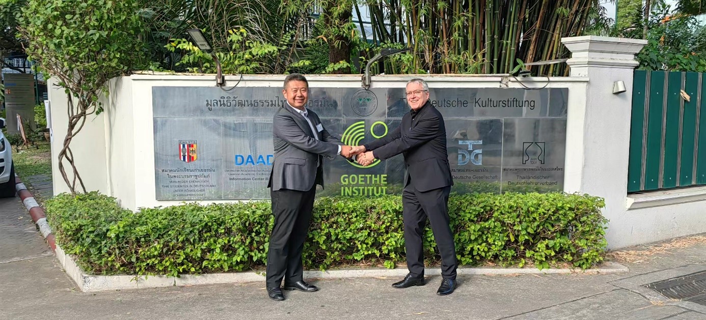
Als eines der sieben vom BMFTR geförderten Projekte nahm IMECOGIP an der Auftaktveranstaltung teil, die am 16. und 17. Dezember 2025 im Goethe-Institut in Bangkok, Thailand, stattfand. Prof. Dr. Harald Zepp (Ruhr-Universität Bochum) und Prof. Dr. Nannan Dong (Tongji-Universität, Shanghai) stellten die Ergebnisse der „Forschungs- und Entwicklungsphase” von IMECOGIP sowie die Pläne für die „Umsetzungsphase” vor.
Für weitere Informationen verweisen wir auf die Mietteilung von der offiziellen FONA-Internetseite:
https://www.fona.de/en/current-issues/news/2025/12/251218_SURE_Start_Implementation_Phase.php
Im Anschluss an den Besuch in Qingdao war Prof. Dr. Harald Zepp am 13. und 14. Dezember 2025 Gast am Tongji Urban Planning and Design Institute (TJUPDI), das von Prof. Dr. Nannan Dong hervorragend organisiert wurde. Das TJUPDI ist eine Ausgründung der Tongji-Universität und fungiert als unabhängige, führende Institution in den Bereichen Stadt- und Raumplanung sowie Landschaftsarchitektur. TJUPDI ist kürzlich vom chinesischen „Ministry of Natural Resources“ in Anerkennung der exzellenten Leistungen im Umweltmanagement ausgezeichnet worden. TJUPDI bearbeitet Planungsaufträge von der Provinz und der Stadt Shanghai.
Das Ziel des Treffens im TJUPDI war der Austausch von gegenseitigem Lernen aus der Anwendung von EnhancES in der Praxisplanung in Shanghai. Ein Schwerpunkt für die kommenden Jahre ist die ‘Ökologische Planung im ländlichen Raum.’ Dank des großen Einsatzes von Prof. Dong bei der Politikberatung ist EnhancES als Werkzeug zur Bewertung von Ökosystemleistungen nun in einen Arbeitsablauf für Naturschutz- und Restaurierungsprojekte in den peri-urbanen Gebieten Shanghais integriert.
In Deutschland zielt unser Projekt darauf ab, ein ähnliches Ziel zu erreichen: die Integration der multiskaligen Bewertung von Ökosystemleistungen in einen Arbeitsablauf für die Raumplanung, mit besonderem Fokus auf städtische Gebiete. In dieser Hinsicht dient der in Shanghai demonstrierte Ansatz als vorbildliches Rollenmodell.
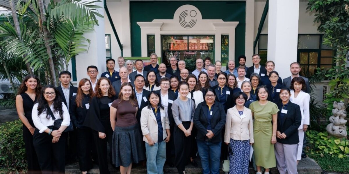
Im Dezember 2025 hat IMECOGIP an verschiedenen Orten in Asien die Inhalte der Implementierungsphase von EnhancES präsentiert: in Qingdao (China), Shanghai (China) und in Bangkok (Thailand). Das übergeordnete Ziel war es, in China die Praxisanwendung von EnhancES voranzutreiben. Begleitet wurde Prof. Dr. H. Zepp, der Verbundkoordinator, von Dr. P. Sliwka vom DLR Projektträger, der auf dieser Reise das IMECOGIP-Projekt besuchte. In Bangkok fand das Kick-off Event für die Implementierungsphase aller in SURE (Sustainable Development in China and East Asia) vereinten Projekte statt. Wir berichten in den nächsten Wochen über diese drei Stationen der Reise und beginnen mit Qingdao. 🌏🌆
Der lokale Praxispartner in Qingdao ist das Qingdao Surveying and Mapping Institute (QSMI). QSMI ist ein Dienstleister, der auf zahlreichen Feldern der Vermessung und Umweltbeobachtung und-analyse arbeitet. Unter anderem unterstützt QSMI die Planung einer High Tech Development Zone im Norden der Stadt, die nach Prinzipien der Grünen Stadt, Schwammstadt und CO2-neutralen Stadt entwickelt werden soll. Hier wird EnhancES in der Planungspraxis eingesetzt. Die chinesischen Partner informierten über ihre bisherigen Anwendungen von EnhancES in diesem Stadtentwicklungsprojekt und erläuterten ihre geplanten nächsten Schritte. Prof. Dr. Harald Zepp stellte die neuesten Entwicklungen rund um EnhancES vor. Er erläuterte beispielhafte Anwendungen von EnhancES in Deutschland. Am Nachmittag gab es die feierliche Eröffnung des „Sino-German IMECOGIP-EnhancES Innovation Studio“, das seinen Platz im neuen Gebäude des International Centers des QSMI finden wird. 🏢🤝
Das kurze, von QSMI bereitgestellte Video illustriert den Besuch. Die einzelnen Stationen waren:
IMECOGIP ist ein gemeinsames Forschungsvorhaben vom Geographischen Institut der Ruhr-Universität Bochum und des Instituts für Landes- und Stadtentwicklungsforschung (ILS Research gGmbH).
Am 21. März besuchte das IMECOGIP-Team (Prof. Dr. Harald Zepp, Malte Bührs (MSc), Lars Gruenhagen (MSc) von der Ruhr-Universität Bochum; Chiara Iodice (MSc) von ILS Research) Qingdao, um die Implementierung von EnhancES vorzubereiten, der Toolbox für die Bewertung, Kartierung und Aufwertung von Ökosystemleistungen in Ballungsräumen. Das Team, das von Prof. Dr. Dong Nannan von der Tongji-Universität in Shanghai begleitet wurde, wurde vom Qingdao, Survey and Mapping Institute (QSMI) (Direktor Zhang Zhihua, Vizedirektoren Ding Penghui und Zhu Xiangshan) eingeladen.
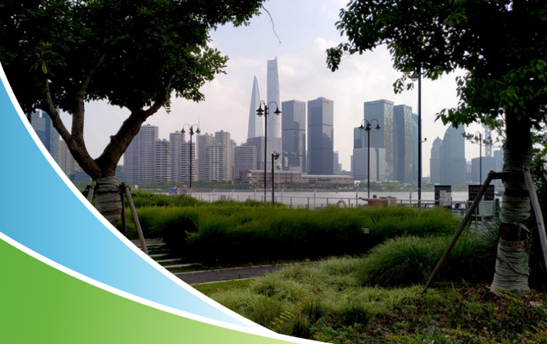
QSMI hatte ein ganztägiges Programm vorbereitet, vollgepackt mit Sitzungen, Besichtigungen, Treffen und Workshops. Am Vormittag wurde ein neu angelegter Park am Wasser in der Qingdao National High Tech Industrial Development Zone besichtigt. Der Park ersetzt die Salzgewinnungsfelder, auf denen früher Salz durch Sonnenverdunstung gewonnen wurde. Später wurden auch traditionelle Techniken der Salzgewinnung aus Solen besichtigt. Vor dem Mittagessen fand ein langes und intensives Treffen mit den Verantwortlichen von QSMI und der Gemeinde statt, um die Möglichkeiten der Anwendung von EnhancES bei der Planung grüner Infrastrukturen und der Verbesserung der Ökosystemleistungen im Bezirk zu erkunden. Herr Pu Hongqiang, der Bürgermeister des Bezirks, und Planungsexperten der Stadt stellten sachkundige und differenzierte Fragen, die ihren hohen Wissensstand über IMECOGIP unter Beweis stellten. Nach dem Mittagessen wurde eine Industriebrache einer ehemaligen Alkalifabrik besichtigt. Das Symposium am Nachmittag in der QSMI-Zentrale diente den QSMI-Experten und dem IMECOGIP-Team als Plattform, um sich gegenseitig über Forschungs- und Planungsverfahren zu informieren und Optimierungsmöglichkeiten auszuloten. Etwa 60 Experten und Wissenschaftler verfolgten die Diskussionen, die mit Hilfe von KI-Übersetzungstools übersetzt wurden.
Der Besuch in Qingdao war eine Folgeveranstaltung eines EnhancES-Schulungsworkshops für QSMI-Experten, der im Sommer 2024 in Bochum stattfand, nachdem ein erster Besuch der deutschen Seite in Qingdao im Frühjahr 2024 stattgefunden hatte.Eine Kooperationsvereinbarung zwischen QSMI und dem IMECOGIP-Projekt war 2024 unterzeichnet worden.
Das Video fängt die Höhepunkte des Tages in einer leicht veränderten chronologischen Reihenfolge ein.
Freundlicherweise zur Verfügung gestellt von QSMI.
Die strategische Planung "Grüner Infrastruktur" (GI) in urbanen Räumen wird von der EU und Deutschland aktiv gefördert. Auch in China rückt mit dem 2018 gegründeten "Ministry of Natural Resources" eine integrierte räumliche Entwicklungsplanung in den politischen und wissenschaftlichen Fokus. Der Nutzen Grüner Infrastruktur zeigt sich in der Stärkung vielfältiger Ökosystemleistungen (ES) und in der Umsetzung naturbasierter Lösungen. Nachhaltige Stadtentwicklung ist in China und in Deutschland eng verknüpft mit den Zielen von Klimaschutz und Klimaanpassung. Zu beiden vermag Grüne Infrastruktur Beiträge zu leisten. Der Transfer von Wissen und Methoden in die Planungspraxis unter Beachtung der spezifischen, kulturell, gesellschaftlich und regional bedingten Governance-Arrangements beider Länder ist die Herausforderung, derer sich das beantragte Projekt annimmt.
Das Projekt startete 2018 mit einer 18-monatigen „Definitionsphase“, gefolgt von der „Forschungs & Entwicklungs“-Phase, die bis März 2025 andauern wird. Die Implementierungsphase kann in einer Durchführungsphase abgeschlossen werden. Die Ziele des Projekts umfassen:

1 / 5

2 / 5

3 / 5

4 / 5

5 / 5
Planer:innen, Landschaftsarchitekt:innen und Gärtner:innen verschönern unsere Städte, indem sie städtische Grünflächen mit Baumgruppen, Blumenbeeten, Wiesen und Rasenflächen planen, realisieren und pflegen. Auch Teiche, Bäche und Seen erfreuen die Stadtmenschen. Im Idealfall bilden diese mit natürlichen Elementen ausgestatteten Flächen ein strategisch geplantes Netz quer durch die Städte, die so genannte Grüne Infrastruktur. Gesetzliche Vorgaben, Ziele der nachhaltigen Entwicklung und Strategien für Klimaschutz und -anpassung sowie die Förderung der biologischen Vielfalt setzen auf eine effiziente grüne Infrastruktur.
Grüne Infrastruktur leistet mehr, als nur schön zu sein. Wir Menschen profitieren von Ökosystemen stärker, als uns normalerweise bewusst ist. Grüne Infrastruktur besteht aus Ökosystemen, die eine breite Palette an Leistungen erbringen. So mindern beispielsweise Bäume die Luftverschmutzung und binden Kohlenstoff, in Städten mildert die Entsiegelung befestigter Flächen Sturzfluten und eine sorgfältige Auswahl von Pflanzenarten verbessert die Bestäubung und stabilisiert Ökosysteme. Dank des Konzepts der Ökosystemleistungen können wir den Nutzen, den die Menschen aus der Natur ziehen, systematisch beschreiben, kartieren und quantifizieren.
Wie der Name schon sagt, konzentriert sich das Projekt IMECOGIP auf die Anwendung des Konzepts der Ökosystemleistungen in die Planung grüner Infrastruktur, um die Widerstandsfähigkeit der Metropole Ruhr und chinesischer Megastädte zu stärken. Geleitet durch die Überzeugung, dass grüne Infrastruktur Trägerin von Ökosystemleistungen ist, entwickelt IMECOGIP innovative Methoden zur Bewertung Grüner Infrastruktur unter Berücksichtigung kultureller, sozio-ökonomischer und klimatischer Faktoren. Das Projekt rückt Methoden für die Planung grüner Infrastruktur in dicht besiedelten städtischen Gebieten in den Mittelpunkt und überträgt diese Methoden in die Planungspraxis beider Regionen. IMECOGIP fördert die praktische Umsetzungsforschung durch die Zusammenarbeit mit Entwickler:innen und Interessengruppen in Deutschland und China.
EnhancES. Die IMECOGIP-Toolbox zur Modellierung, Kartierung, Bewertung und Verbesserung von Ökosystemleistungen.
Zur Unterstützung der Planung entwickeln die Ruhr-Universität Bochum und das Institut für Landes- und Stadtentwicklung in Dortmund (ILSResearch) gemeinsam mit unseren Kollegen von der Tongji-Universität EnhancES die Toolbox zur Modellierung, Kartierung und Quantifizierung von insgesamt zwanzig verschiedenen Ökosystemleistungen bestehender und geplanter Grüner und Blauer Infrastruktur. Im Zuge des Stadtumbaus und bei Neubauplanungen sollten Praktiker die Ökosystemleistungen antizipieren und optimieren, die mit der Grünen Infrastruktur verbunden sind. So lässt sich abschätzen, warum genau welche Kombinationen von grünen Elementen sinnvoll ist. EnhancES basiert auf dem CICESv5.1-Klassifizierungsschema, das eine umfassende und weithin akzeptierte Liste von Ökosystemleistungen, ihren Merkmalen, spezifischen Vorteilen und Beispielen enthält. Die Auswahl der Modelle (Tab. 1) erfolgte nach Diskussionen zwischen Planer:innen, Expert:innen und Wissenschaftler:innen aus Deutschland und China, die über eigene Erfahrungen in der Stadtplanung und Umweltanalyse verfügen.
Entwicklungslogik
Die Nutzer geben Biotop-, Boden- und Klimainformationen in EnhancES ein, die Software ordnet notwendige zusätzliche Parameter zu, modelliert die Ökosystemleistungen und stellt sie in Karten dar. Die Rechenzeit ist minimal, um die Bewertung von Planungsvarianten oder größeren Gebieten zu erleichtern. EnhancES arbeitet mit einer Hierarchie von Landnutzungs-/Bodenbedeckungs- und Biotoptypenklassen. Sie ermöglicht Bewertung planungsbegleitend entsprechend der Verfeinerung von der Entwurfsplanung bis zu detaillierteren Plänen. Sekundäre Daten, die EnhancES nicht automatisch den Biotoptypen zuordnet, wie z. B. Landschaftsstrukturmaße in Parks, werden automatisch aus den bereitgestellten Geodaten berechnet.
Nach seiner Fertigstellung wird EnhancES quelloffen sein und öffentlich verfügbar gemacht, so dass die Nutzer:innen ihre eigenen Datensätze an ihre Untersuchungsgebiete anpassen können. Entweder übersetzen sie ihre eigenen Landnutzungsklassen/Biotoptypen in die vorbereiteten Standardtypen oder sie entwickeln ihre eigenen Datensätze aus Landnutzungsklassen/Biotoptypen und zugehörigen Modellparametern.
Anwendungsfelder in China und in Deutschland
EnhancES animiert zum Umdenken. EnhancES erweitert die Perspektive vom traditionellen, auf Schutzgebiete beschränkten Naturschutz hin zur Bewertung und Verbesserung von Ökosystemleistungen in städtischen und stadtnahen Gebieten mit unterschiedlicher Landnutzung - wo immer dies möglich ist.
In Deutschland nutzen wir EnhancES, um zwischen konkurrierenden Gestaltungsplänen für neue Stadtteile zu entscheiden, für Stadterneuerungsprogramme, für die Planung von Grünflächen und für die Ökosystembilanzierung. In China sehen wir ein großes Potenzial für weitere Anwendungen, zum Beispiel für die territoriale Raumplanung, im Rahmen der sogenannten „Guidelines for the Construction of Carbon Peak and Carbon Neutrality Standard Systems“, für Klimaanpassungspläne sowie für die Nationale Klimawandel-Anpassungsstrategie 2035.
EnhancES hilft Ihnen auf vielfältige Weise bei der nachhaltigen Entwicklung von Plangebieten:
Forschende präsentieren ihre Ergebnisse bei der zweiten SURE-Statuskonferenz in Bangkok, Thailand. Wie kann nachhaltige Stadtentwicklung und Klimaanpassung urbaner Räume gelingen?
Reger Austausch auf der zweiten SURE-Statuskonferenz: 100 Forschende der zehn Verbundprojekte trafen sich mit ihren Partnerorganisationen zur Vernetzung und, um den Transfer der Forschungsergebnisse in den beteiligten Regionen zu intensivieren.
Nach der Berufung von Prof. Dr. Harald Zepp in den wissenschaftlichen Beirat des "Technology Innovation Center for Landscape Eco-Restoration in Greater Metropolitan Areas" des "Ministry of Natural Resources" der VR China und zwei erfolgreicher Feldforschungsphasen wurde ein weiterer wichtiger Meilenstein im IMECOGIP-Projekt erreicht. Gemeinsam mit fünf chinesischen Kollegen der Tongji, East China Normal und Shanghai Universität sowie der China Academy of Sciences fand zwischen dem 27.-30. Oktober ein dreitägiger Workshop im Ruhrgebiet statt.
Beim Kick-Off-Meeting in den Räumlichkeiten des UNESCO Welterbes Zeche Zollverein in Essen stand am ersten Tag ein interdisziplinärer und praxisnaher Austausch von State-of-the-Art-Methoden zur Bewertung von Ökosystemleistungen in der Grünen Infrastruktur mit Vertretern aus Verwaltung und Projektpraxis im Fokus (siehe Programm). Von Experten geleitete Exkursionen (unter anderem Industriewald Zollverein, Emscher-Umbau, Biomassepark Hugo) gaben am zweiten Tag Einblicke in die aktuelle Best-Practice Grüner Infrastruktur und damit einhergehende Ökosystemleistungen in der Metropole Ruhr.
Das Expertenwissen aus Wissenschaft und Verwaltungspraxis floss in die an beiden Tagen anschließenden Workshop-Einheiten ein. Hier kam das interdisziplinäre Kompetenzspektrum der Chinesischen Delegation bestehend aus Landschaftsarchitekten- und Planern, Natur- und Umweltwissenschaften sowie Sozialwissenschaften besonders zum Tragen. Ging es in der ersten Einheit um die Bewertung ausgewählter Ökosystemleistungen in Abhängigkeit von der jeweils vorliegenden Landnutzung, eruierte man in der zweiten Einheit gemeinsam anzuwendende Erhebungsmethoden und besprach komplementäre Arbeitspakete bis zum nächsten Workshop in Shanghai.

1 / 12

2 / 12

3 / 12
4 / 12

5 / 12

6 / 12

7 / 12

8 / 12

9 / 12

10 / 12

11 / 12

12 / 12

Prof. Dr. Harald Zepp (Projektleitung)
Geographisches Institut (Raum IA 6/117)
Fakultät für Geowissenschaften
Ruhr-Universität Bochum
D-44780 Bochum
Fax +49-(0)234 32 14469
Tel. +49-(0)234 32 23313
E-Mail: harald.zepp@rub.de
Ralf Zimmer-Hegmann, Dr. Kathrin Specht (Verbundpartner)
ILS - Institut für Landes- und
Stadtentwicklungsforschung gGmbH
Brüderweg 22–24
D-44135 Dortmund
Fax +49 (0)231 9051 155
Tel. + 49 (0) 231 9051 234
E-Mail: barbara.schroeter@ils-forschung.de
Homepage: https://www.ils-forschung.de/
Copyright © Geographisches Institut 2026
Letzte Änderung: 12. Mär. 2026
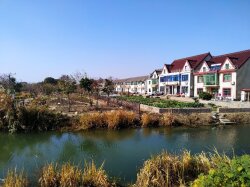
 im Dorf Shuiku, Shanghai")
